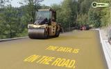
The machine control market is evolving fast and is increasingly becoming part of a much wider construction site management concept, Mike Woof reports
Machine control technology has come a long way in the past 20 years and the development of 2D and 3D systems has been rapid in the construction sector. These have evolved from comparatively simple technologies using signals from locally-mounted total stations to send out signals that could be picked up by laser arrays mounted on a bulldozer or grader. Early systems provided machine operators with simple visual guides as to how deep to cut, allowing a dozer or grader blade to be controlled and kept on grade. These systems had shortcomings though and were limited when it came to constructing complex cambers and also required a high degree of calibration. Used by specialist contractors only for the most part, the early systems were too expensive and too complex for the majority of firms to consider.The various machine control systems have equally benefited from new software and more powerful computer hardware, at less cost to the customer. At the same time the market has moved on a long way with the rapid development of GPS solutions, which have become increasingly cost efficient and accurate. Users are now able to access higher resolution GPS tracking signals backed up by the establishment of the Russian Glonass satellite network and the prospect of the European Galileo system to come. Cross-referencing these satellite tracking systems with total stations on-site has allowed precision to millimeter accuracy and some of the latest packages even allow full-speed operation of a dozer, with semi-automatic control of the blade. At the same time the use of machine control packages in earthmoving has spread from blade guidance for dozers and graders, taking in scrapers, excavators and soil compaction machines. Road construction machines such as concrete pavers, milling machines, asphalt pavers and asphalt compactors can also be guided by machine controls systems.
Furthermore the closer links between construction software houses and the machine control system providers, most notably Leica Geosystems,
Because of this much closer interaction with software firms, and the machine control specialists, the three major GPS and machine control system providers, Leica Geosystems, Topcon and Trimble, have all steadily been moving beyond simply providing machine guidance tools. The aim of all three firms is to provide a portfolio of technology solutions for overall site management. Rather than offering packages that can be set to work with software packages from other suppliers, these three companies are also buying into the software sector. One of the most notable developments in this regard was the recent purchase of Intergraph by the
This move will see specialist Intergraph becoming Hexagon's core software provider and the business will continue to provide software solutions to its core industries. Intergraph will retain its brand name and will operate as a separate Hexagon division. The intention is to integrate Intergraph software with Hexagon's measurement and precision technology systems, including those from Leica Geosystems. The benefit for Hexagon will be easier production of visual presentations for management, analysis and sharing of critical data.
New machine control option
UK-based firm
The Dig Pilot package features a touch screen display, making it easy to use for an operator. The system can be used on large sites with total station technology and he said, "It comes as standard with a laser receiver." Adams said, "It's been designed for self-installation and the real advantage is portability. In less than two hours you can install it and calibrate it." He explained that at the end of the shift, an operator can easily unclip the units and take them away for safe storage away from the machine. This is also useful should the contractor want to switch an excavator from excavating work with a bucket to other tasks such as breaking using a hydraulic hammer. This point is of particular importance given the increasingly large quantities of data being generated from on-site tools such as machine control equipment. Handling real-time data from construction sites and using this efficiently is proving a challenge for the industry, which will be solved by new software suites.
On a slightly different level it is worth noting too that Trimble and
Sophisticated data capture
Trimble has developed its new MX8 Mobile Spatial Imaging System, an advanced mobile data capture system. This package combines imaging and laser scanning capabilities to measure objects in 3D to produce 3D, 4D and 5D data sets for spatial imaging projects. The system is ideal for as-built modelling, inventory, inspection, encroachment analysis, and asset management for roadways, bridges and other infrastructure.
The package is designed to capture comprehensive eye-level views from the ground. This ground-based sensor delivers centimetre positioning accuracy, 3D measurements and video imaging even when recording the data. The Trimble MX8 collects 3D data fast and accurately and features a pod-type design, allowing it to be installed on a variety of vehicles. Its scalable system configuration and sensor upgrade options allow owners to suit the package to specific requirements.Operating at highway speeds, the Trimble MX8 allows users to capture more frequent updates of 3D datasets for infrastructure. Combined with Trimble Trident Analyst for Spatial Imaging software, automated extraction of road signs, road geometry, break lines and lane markings reduces manual labor and provides answers earlier in the project. Change detection between current and past datasets allows monitoring of project progress throughout the plan, design, build and maintain phases.


