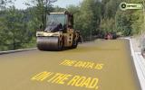
Using the latest machine control technology has helped speed work to improve a dangerous stretch of road in Canada.
A Canadian contractor has carried out major roadworks to improve safety on a dangerous stretch of road, using technology to complete the work smoothly
In the contracting sector the firm works in most of British Columbia and currently owns more than 40 pieces of heavy machinery, with the majority of these units featuring
"We are early adopters of technology in our geographic area with purchasing earlier Trimble systems about four or five years ago," said Dustin Dobbin, vice president and daily operations manager for Wiltech Developments, "The technology has enabled us to tackle major highway projects and large site grading, as well as water, sewer, and other specialised work that a medium-sized contractor like us couldn't handle otherwise." Dustin continued, "We're performing more survey and volume calculations, and are specialising in more turnkey, lump-sum contracts, where we can help clients with the geotech analysis, consulting, and confirming numbers by doing the volume calculations and drilling underneath the dirt to confirm underground surfaces. We want to give them good, hard numbers so that when their budgets come in that that's it. There are no hidden costs."
The machine control package has come in useful on one recent project Wiltech handled as general contractor. This was a roadrealignment to eliminate two dangerous curves on Highway 97 in the Wright Station Road area, near Lac la Hache in British Columbia. The Wright Station Curves Project featured 4.2km of realignment and widening to four lanes, according to Willie Dobbin, president of Wiltech Developments. "It involved just over 500,000m3 of total earth movement, including gravel." "It started out as a smaller US$8 million project but as we got into it the geotechnical complications dictated that we had to change what we were doing," Willie Dobbin explained. "We had to perform a lot of subdrain work because we had water interfering and migrating from the side because of wetlands and water seepage coming from the neighbouring farmlands."
Wiltech used its Trimble grade control package to create designs in the field. "We could record the elevation and location of where the drain had to finish, and then record where we had to intercept water to decipher whether or not other arrangements or plans had to be made, Dustin Dobbin said. "In most cases this was quickly and easily determined in the field with minimal time lost or additional cost. Also, since the final design is in the machine, the operator could, by switching between designs, determine if the design created in the field would work with the finished plan. In most cases, after looking at the issue, the operator could help determine the best course of action from their 'seat.'"
As a result, the project required a lot of deep trenching, sub-drains and pipes, and crossings and then backfills. "Due to the mountainous terrain, some of the roadbed cuts were approximately 30-35m on the highest cut, and some of our fills were on 22m deep," Willie Dobbin said.
Wiltech needed to balance out the cut and fill on the project, while placing geo-grids and gravels where it was necessary. Some 60,000-70,000m2 of geo-textile cloth was laid in addition to 3-4km of pipe, in instances where interceptor ditches on the top of the cuts were required. Trimble construction software with two-way data and a productivity module helped with the layout.
"We'd put a drainage system in there, which would basically be drain rock, or a combination of geotextile cloth and drain rock, or it would be pipe surrounded by drain rock with cloth," Willie Dobbin said. "We wanted the water to collect into the pipes, and then cross drain across the highway." Willie Dobbin continued, "There was a tremendous amount of sub-excavation; deep-ditch drainage systems to relieve the water under the road and bury it all. This was a complex project, which took two years, exactly, to complete. Considering the adversity we encountered during that time, we certainly completed everything faster than anyone could have expected. Having Trimble systems that allowed us to productively bulk, clean-up/finish all at once, made it easier to excavate and repair saturated areas. In several cases areas completed to sub-grade and approved within accuracy tolerance had to be re excavated to a set elevation below subgrade and have filter cloth and geo-grid installed. Having the ability in the machine to set offsets to load into rock trucks saved us a tremendous amount of time as well as helping keep track of volumes and changes made in the field. Once repaired that same machine could then finish that area to sub-grade again without tying up surveyors.
In essence, the operator becomes their own surveyor, having stakes wherever they are needed." There was typically a Wiltech crew of 25-30 working on the Wright Station Curves Project at any given time. Five rock trucks, two water trucks, six excavators, three dozers, two graders, and two end-dump gravel trucks were used. "A critical dimension to our equipment list on this project is the amount of GPS machine control we used throughout the project," Dustin Dobbin said. "This was the first sort of truly stakeless job of its kind in Western Canada. There wasn't one stake on that job at all." Willie Dobbin said, "We've been using machine control for a few years now so when we initially met with the Canada Ministry of Transportation and Highways at our preconstruction meeting the 12 or 14 Ministry representatives for the province just about fell out of their chairs when we mentioned we planned on using very few stakes, considering the scope and amount of work to be done. They just shook their heads and said, 'We'll see.'" Willie Dobbin continued, "Our personnel required no stakes, however Ministry reps and some of the company's subcontractors required stakes....for mere visual reference." When Wiltech began the project, they used an excavator equipped with a machine control system to excavate a slope which had a 10cm deviation tolerance. "The Ministry's quality control monitors visited the site and measured the slope and couldn't find any deviations at all.
In fact, they were so impressed we were able to talk them into purchasing their own Trimble GPS system so that we'd be on the same page," Willie Dobbin said.
"We understand our data prep has to be bang on to take full advantage of the technology, so we have our own in-house data prep technicians to help us save time and minimise room for errors or project down time," said Dustin Dobbin. "We want to be thorough and maintain control over the project." On the Wright Station Curves Project, Wiltech started the work by first calibrating the site. "We know that the control points that the road engineers use for creating the site plan are based on what the surveyors provide, so we like the original data, if we can get it," said Dustin Dobbin. "We were able to work with the engineers at the Ministry to provide a model that we could work with using the software to develop the data prep." The firm used a site positioning system GPS antenna as the base station along with a couple of radios to function as repeaters in order to expand the signal reach throughout the site.
The base station has a 2.4km range and tracks L1/L2 GPS carrier signals.
With its complexity, it was almost inevitable that there would be plenty of changes and adjustments made during the Wright Station Curves Project.
"To be honest, if we were using stakes, we wouldn't have kept up on that project with how fast it was changing, there's just no way," Dustin Dobbin added. "We would have had some days where there would have been five surveyors running around, we would have been completely lost." "If anything, I think it saved the Ministry money because of how productively the project was managed, because normally they'd have to pay us on those portions of the job where extra work orders would have been required," said Willie Dobbin. "There were clearly survey-costs savings, as well as tremendous savings from not having labour and machines waiting for surveys and staking." Additionally, Wiltech cited cost-savings during the production of the job.
Conventional methods employ big machines first, followed by smaller machines to get closer, and then finish-graded by a third machine. "We didn't do that," Willie Dobbin said, "The machine control is so accurate, we were able to get pretty close to finish grade using our big excavators and dozers. And then we'd run a grader with the grade control system over the top with the compactor behind it to calibrate and we're done." Willie Dobbin commented, "First, we were able to start and complete a project from one end to the other without a single survey stick.
That's an incredible cost and time saving." Dustin Dobbin added that the firm also brought machine control technology to the Canada Ministry of Transportation and Highways for the first time, which now accepts the concept and will rely on it for quality control.


